|
Welcome to East Granby
The
town of East Granby, originally settled in 1710 and incorporated in
1858, is a residential, commercial/ industrial, and agricultural
community encompassing 17.8 square miles in north central Connecticut.
The town is situated approximately 12 miles north of Hartford, 14
miles south of Springfield, Massachusetts, and adjoins Bradley
International Airport in Windsor Locks, Connecticut.
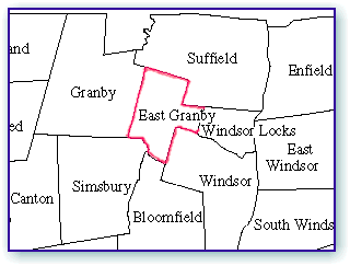
Adjacent communities include Bloomfield, Granby, Simsbury,
Suffield, Windsor and Windsor Locks, Connecticut.
The
town of East Granby employs the Town Meeting Board of Selectmen form of
government. The Town Meeting serves as the legislative body, with a
First Selectman serving as the full-time Chief Executive and Chief of
Police. A six-member Board
of Finance serves as the town's financial control, in conjunction with a
part-time Treasurer.
The
town's population is 4,423 according to the 1998 data.
More than 23 percent of the town residents are engaged in
manufacturing, and more than 17 percent are in the financial, real
estate and insurance industries.
East
Granby affords the location, demographics, opportunities and amenities
sought by viable businesses. Growth
in recent years has been primarily commercial and industrial as the town
has taken advantage of its proximity to 1-91, Bradley International
Airport and the new Air Cargo Terminal located within the town.
Some of the larger companies with facilities in East Granby
include Cerock/Rockbestos, Galasso Holdings LLC, Hartspring Associates,
and Griffin Land & Nurseries, Inc.
|
POPULATION
1980
1990
1998
2003
%
Growth 98-03 |
Town
4,102
4,302
4,423
4,486
1.42% |
MetroHartford
668,483
709,404
692,087
683,927
|
State
3,107,580
3,287,116
3,271,239
3,272,149
0.03% |
HOUSEHOLDS
1990
1998
2003 |
Town
1,624
1,673
1,703 |
MetroHartford
268,396
262,715
260,456 |
State
1,230,479
1,229,087
1,233,636 |
AGE
DISTRIBUTION
1998
0-4
5-17
18-24
25-49
50-64
65+ |
Town
6.69%
17.36%
7.14%
38.71%
18.47%
11.62% |
MetroHartford
6.5%
16.7%
8.2%
38.5%
15.8%
14.3% |
State
6.61%
16.83%
8.56%
38.45%
15.26%
14.29% |
MEDIAN AGE
1998 |
Town
39 |
|
State
37.2 |
RACE/ETHNICITY
1998
White
Black
Asian
Pacific
Native
American
Hispanic
Other |
Town
95.70%
1.76%
.54%
.09%
1.88%
.02% |
MetroHartford
76.1%
11.2%
2.4%
0.2%
10.0%
0.2% |
State
80.95%
8.38%
2.24%
.18%
8.08%
.16% |
1998
People
per sq. mile |
Town
253.03 |
MetroHartford
926.2 |
State
653.07 |
AREA
Total
sq. miles |
Town
17.48 |
MetroHartford
747 |
State
4845.1 |
|